Walking in Thomastown: Edgars Creek and Local Heritage Routes
The best walking in Thomastown follows Edgars Creek, a flat, quiet corridor of shared paths that links the suburb to the wider Merri Creek network. You do not need a car, special gear or a big block of time. A 60 to 90 minute loop gives you open grassland, creek views and a clear sense of the land under the suburb. This guide covers the route, the nature along it, who looks after it and the heritage that sits beneath every step.
Where Do You Actually Walk in Thomastown?
Most people think of Thomastown as factories, shops and houses. The walking lives in the gaps. Thomastown, Victoria has a thin green spine that runs along its creek lines, and the Edgars Creek Trail is the one to learn first.
Here is the simple map in your head. Edgars Creek runs south through the suburb. Paths follow it for long stretches. Further west sits the Merri Creek, with its own long trail. To the east, the Darebin Creek has a separate trail system. Thomastown sits between these waterways, which is why a short walk can feel so open.
When I first walked this area, I expected to hit a road every few minutes. What I found was long runs of path with only a few crossings. That surprised me. Industrial streets sit close by, yet the creek corridor feels set apart from them.
What Is the Edgars Creek Trail Like on Foot?
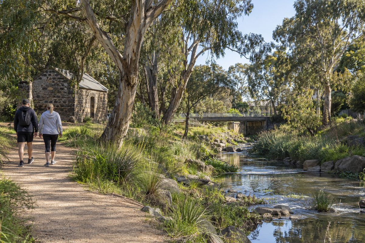
The Edgars Creek Trail is a gentle, mostly flat walk. It suits beginners, prams, older walkers and anyone returning from an injury. There are no big climbs. The surface is mainly sealed path, with some gravel and grass edges.
You will notice three things quickly: wide sky, long grass and the sound of birds over traffic noise. Water is not always flowing hard. Edgars Creek can look low and slow in dry weeks and surprisingly fast after heavy rain. Both versions are worth seeing.
One of my clients, a man in his sixties who had just had knee surgery, started with 20 minutes along this trail. He had avoided hills for months. The flat path let him build up to an hour in six weeks. He told me the best part was that he never felt far from a bench or a street exit.
Practical tips for the trail:
- Wear shoes with grip. Grass edges get slick after rain.
- Carry water. Shade is patchy in the open stretches.
- Walk in the morning or late afternoon. Midday summer sun is harsh on open ground.
- Keep left on the path and listen for bike bells.
How Does This Walk Connect to the Merri Creek?
Edgars Creek is a tributary. It drains into the Merri Creek further south, and the paths follow that logic. If you want a longer day, you can follow the trail toward the Merri Creek Trail, which is one of the best-loved walking and cycling corridors in northern Melbourne.
The Merri Creek in turn flows into the Yarra River. That means a walk in Thomastown is a small upstream piece of the same water story that runs through the whole city. Standing beside a quiet creek in the north and knowing it ends up in the Yarra River changes how you look at it.
The Darebin Creek is a different catchment, not a branch of this one. It has its own trail and its own feel. If you like creek walks, try both in one weekend and compare. I did this with a friend who had lived in the area for years. She had never crossed between the two, and she was surprised by how different the vegetation was.
Why Does the Riparian Zone Change Your Walk?
The riparian zone is the strip of land beside a creek where the soil, plants and animals are shaped by the water. It is the reason the trail feels different from a normal footpath. You get more birds, more insects and cooler air near the banks.
Healthy riparian land does real work. Plant roots hold the bank together. Grasses and reeds slow runoff and catch dirt before it reaches the water. Trees give shade that keeps the creek cooler for small animals.
Here is what to look for as you walk:
- Native grasses and rushes growing close to the water.
- Fresh plantings with small guards, which show recent restoration work.
- Bare, eroded banks, which show where the creek is struggling.
- Waterbirds, honeyeaters and the odd raptor hunting over open grass.
Most walkers miss the angle that matters here. They treat the creek as a backdrop. It is better to treat it as the point of the walk. Stop for two minutes at a bend and watch. You will see more than you do while moving.
Who Looks After These Paths and the Creek?
Knowing who manages the land helps you report problems fast. Several groups share the job.
The City of Whittlesea looks after local paths, parks, signs and much of the everyday upkeep in this part of Thomastown. If you spot a broken section of path, rubbish or a damaged sign, the council is where you send the report.
Melbourne Water manages the waterways and drainage. It is responsible for creek health, flood management and a lot of the waterside land. If you see pollution in the water, a blocked drain outlet or serious bank erosion, that falls to Melbourne Water.
Community groups also plant, weed and monitor along Melbourne's creeks. Volunteering one morning teaches you more about the corridor than a dozen walks. A client of mine who joined a planting day said the same thing. She went to meet people and ended up learning to name a dozen local plants.
What Heritage Should You Know Before You Walk?
This land has been home to Aboriginal people for tens of thousands of years. The Wurundjeri Woi Wurrung people are the Traditional Owners of much of the Melbourne region, including the creek country around Thomastown. The Wurundjeri Woi Wurrung Cultural Heritage Aboriginal Corporation is the Registered Aboriginal Party that speaks for Country in this area under Victorian law, and it plays a formal role in protecting cultural heritage sites.
Creeks were never just scenery. They were food sources, travel routes and meeting places. Scarred trees, stone artefact scatters and other sites can sit close to waterways. If you ever see what looks like a stone tool or a marked tree, do not touch or move it. Note the place and report it to the relevant authority.
You may also hear the term native title in Australia on a heritage walk. Native title is the legal recognition that some Aboriginal and Torres Strait Islander peoples hold continuing rights and interests in land and waters under their own laws and customs. How it applies varies by place, and in much of southern Australia the history of dispossession makes the legal picture complex. You do not need to be a lawyer to walk respectfully. You need to know that the land has a living owner relationship, not just a past.
A simple habit helps. Before a walk, spend two minutes reading about the Traditional Owners of the area. Then, when you reach the creek, acknowledge Country in your own head. It sounds small. In my experience, it changes how closely people look at the landscape.
What Colonial and Local History Sits Along the Route?
After the Aboriginal history comes the settler layer. The suburb's name and its street grid come from the 1800s, when farmland spread north of Melbourne. Later, industry and housing filled in the paddocks. Creek corridors survived mostly because they flood and could not be built on.
That is a useful way to read the walk. The green corridor you enjoy is, in large part, the leftover land that development could not use. Floodplain land was cheap to keep as open space. So a flat, quiet trail often marks the exact line where a creek used to spill across the plain.
Look for these clues as you go:
- Old fence lines and stone remnants in open paddock edges.
- Large old red gums that predate the houses around them.
- Signs and plaques that name earlier farms or community groups.
- Sudden changes in land level that show where floodwater once ran.
How Do You Get There Without a Car?
You can start from public transport. Thomastown railway station, Melbourne sits on the Mernda line, and it is the easiest anchor point for a car-free walk. From the station, local streets lead toward the creek corridor, and the trip is short enough to do on foot.
Epping, Victoria lies just to the north and is another useful reference point. If you want a longer one-way walk, you can start near Epping and head south along the creek, then catch a train back from the Thomastown end. I tried this with a friend on a cool autumn Saturday. We took the train out, walked back, and the whole outing cost us a single fare and some snacks.
The paths that follow the creeks are shared-use paths. That term means walkers, runners and cyclists all use the same surface. A few simple rules keep it friendly:
- Walk on the left and keep dogs on a short lead.
- Do not stop in the middle of the path to take photos.
- Move to the side when you hear a bell.
- Look before you step out from a bend.
What Does a Good 90-Minute Walk Look Like?
You do not need a complicated plan. Use this one as a template and adjust it to your fitness and the weather.
- Start at Thomastown station and walk to the nearest access point to the Edgars Creek corridor.
- Follow the trail for 30 to 40 minutes in one direction. Slow down at the first bend and look at the riparian planting.
- Turn back at a natural landmark, such as a bridge or a path junction.
- Take a five minute rest at a seat or open spot. Read the nearest sign.
- Return along the same path. Everything looks different from the other direction, and you will spot things you missed.
An out-and-back route is better than a loop for most first walks. It removes the stress of navigation. It also lets you judge distance, because you know exactly how far you have gone when you turn around.
What Should You Check Before You Go?
Creek corridors are low-lying, so a few quick checks save a bad day.
- Weather: After heavy rain, low sections of path can be wet or briefly covered. Pick another day.
- Daylight: Some stretches are not lit. Finish before dusk.
- Snakes: In warm months, stay on the path and keep dogs close. Snakes are more active in grassy creek land.
- Phone signal: Coverage is usually fine, but tell someone your route on longer walks.
These are small habits. They matter because the walk is so easy that people stop thinking about preparation. The people who have a bad time are nearly always the ones who ignored the weather.
Why Is This a Smart Way to Learn a Suburb?
If you are thinking about moving to the area, the creek trail tells you more than a real estate listing does. You see how people use public space. You see whether the paths are cared for. You see the mix of residents, from dog walkers to cyclists to families with scooters.
I know this because a client of mine who was house hunting in the north walked the trail three times before making an offer. Once on a weekday morning, once on a Saturday and once after rain. She said the trail confirmed what the numbers could not: the suburb had quiet pockets and real green space. If you want the broader picture of daily life here, our guide to Thomastown is a good place to start.
Your Next Step
Pick one morning this week and walk the Edgars Creek Trail for 60 minutes. Do these four things:
- Take the train to Thomastown station and walk to the creek.
- Stop at one bend for two minutes and name three plants or birds you can see.
- Read the Traditional Owner acknowledgement or local sign you pass, and spend a moment on the history under your feet.
- Note one thing to report or one thing to return for, then book your next walk in your calendar before you leave.
One flat, free walk is enough to change how you see the suburb.