Where Is Thomastown, Victoria? Postcode, Council and Surrounding Suburbs
Thomastown is a northern suburb of Melbourne, about 16 kilometres from the city centre, with the postcode 3074 and a home in the City of Whittlesea. It sits on the flat plain between Reservoir and Epping. Trains, a major freeway and the Hume Highway all pass close by, which is why people often mix it up with the suburbs around it.
This guide gives you a clear picture of where the suburb sits, who runs it, and which places surround it. Use it when you are checking an address, planning a move or working out how to get there.
How Far Is Thomastown From the Melbourne CBD?
It is roughly 16 kilometres north of the Melbourne central business district. By car, expect 25 to 40 minutes off peak. In the morning rush, that can double.
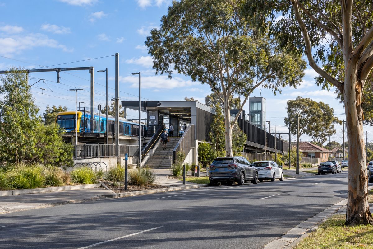
By train, the trip takes about 30 to 35 minutes to the city loop. Thomastown railway station, Melbourne, sits on the Mernda line, so you ride a direct service with no change. The Mernda line runs from the city out through Preston and Reservoir, then on through Keon Park and Thomastown to Epping and beyond.
When I first looked at the suburb for a client who worked in the city, the train decided it. She wanted a direct line and a short walk to the platform. The Mernda line gave her both.
What Is the Thomastown Postcode?
The postcode is 3074. This is the number to use on every form, parcel and delivery address for the suburb.
Here is the catch. Postcodes do not always match suburb borders. Some streets near the edges use a neighbour's number. Lalor is 3075, Epping is 3076, and Reservoir is 3073. If your street sits near a boundary, check the address on the Australia Post lookup tool before you order anything expensive.
One of my clients ordered furniture to a street she thought was in Thomastown. The delivery company had it listed under Lalor. Nothing was lost, but it cost her a week. A thirty-second check would have saved it.
Which Suburbs Surround Thomastown?
The easiest way to place Thomastown is to walk around it in your head. Start at the north and go clockwise.
- North: Lalor is directly next door. The two share a train line and many streets blend from one to the other.
- North-west: Epping, Victoria is a little further up the line. It is bigger on the commercial side, with large retail areas and fast-growing housing estates.
- East: Mill Park, Victoria sits across the way. It is mostly residential, with a large lake and a well-known university campus nearby.
- South: Reservoir, Victoria lies below. It is a large, busy suburb with its own shops and stations. Keon Park, a small pocket of Reservoir, is the closest part to Thomastown.
- South-west: Further down, Preston, Victoria marks the point where the area starts to feel inner suburban. It belongs to a different council, the City of Darebin.
- West: Campbellfield and the industrial belt lie toward the Hume Highway. This side is more factories and warehouses than homes.
That gives you the real shape. Thomastown is a mix of homes in the middle and industrial land on its western edge.
Where Does Thomastown End and Lalor Begin?
There is no wall, and there is no sign. The border runs along a mix of roads and the rail corridor. Walking from one suburb to the other, you will see the same brick homes and the same wide nature strips.
This is why the two names are used so freely together. A real estate listing may say Thomastown when the street is technically Lalor, because buyers search for the bigger, better-known name. When I check an address for a client, I always open the official suburb boundary and look at the street itself.
Here is a quick rule. If the address is south of the rail station area, lean Thomastown. If it sits north, it is more likely Lalor. It is only a rule of thumb, so confirm the exact street before you rely on it.
How Do You Get to Thomastown by Train?
Two stations matter here. Thomastown railway station, Melbourne, is the main one. Keon Park railway station is the next stop toward the city, and it sits just across the suburb line in Reservoir.
If you live near the southern edge of Thomastown, Keon Park may be the closer walk. Many people never think to check. It costs nothing to compare the two, and the difference can be ten minutes on foot.
Both stations are on the Mernda line. Trains run all day, and they run more often at peak times. Check the live timetable on the day you travel, because works on weekends can change the service.
What Are the Main Roads Around Thomastown?
Three roads shape how you move around the area.
- Dalton Road and High Street: These are the local arteries. High Street carries a lot of traffic north and south and links the suburb to Reservoir and Epping.
- M80 Ring Road: This freeway runs across Melbourne's north and gives fast access to the airport and to the west and east. It is the main reason trade and logistics firms set up near Thomastown.
- Hume Highway: This is the old main route north out of Melbourne. It runs close to the western edge of the area, and it carries heavy freight.
I know this from experience. A client who ran a small courier business picked a unit in Thomastown for one reason. He could be on the M80 in under five minutes. Fuel and time dropped the first month.
What Does Living in Thomastown Look Like?
Most of the housing is detached homes on blocks of a decent size, built from the 1960s onward. You will find newer townhouses and units too, often in small groups on subdivided blocks. Prices have usually sat below those of inner northern suburbs, which is a big part of the appeal.
The suburb is also known for its cultural mix. Shops, restaurants and community groups reflect many backgrounds, and you can eat very well along the main strips. Thomastown has a large shopping centre, local parks and sports grounds, so day-to-day needs are close.
What I found when I walked the area was how practical it feels. It is not trying to be trendy. It is a place where people get their errands done, then get home.
Common Mistakes People Make When Placing Thomastown
A few errors come up again and again. Fix them early and you save time.
- Mixing up Thomastown and Thomastown West-style names. Always type the full suburb and postcode.
- Assuming Preston is next door. It is several suburbs away and sits under a different council.
- Using the wrong council for a permit. Applications for properties in Thomastown go to the City of Whittlesea.
- Trusting the listing name. Check the street on the official boundary map.
A Simple Mental Map You Can Remember
Picture a straight line running north from Melbourne's centre. Along that line sit Preston, Reservoir, Keon Park, Thomastown, Lalor and Epping, in that order. Mill Park sits off to the east. The M80 Ring Road crosses the top of the area. The Hume Highway runs along the western side.
That one picture answers almost every location question. It tells you which station to use, which council to call and which suburb a neighbour is likely to live in.
Your Next Step
Write down the exact street address you care about. Enter it into the Australia Post lookup to confirm the postcode, then check the City of Whittlesea website for the council that covers it. In five minutes you will know the suburb, the number and the council, and you can stop second-guessing.
Thomastown is a suburb in Melbourne's north, about 17 kilometres from the CBD, and it falls within the postcode 3074. It is governed by the Whittlesea City Council, which is one example of how Local government in Australia is organised into councils that manage local services and planning. The suburb sits within the Northern Metropolitan Region, and its closest neighbour is Lalor, Victoria, to the north, with Reservoir, Thornbury and Epping also nearby.